Upper Ewaso Ng'iro Catchment, Kenya
MONITORING OF SPRING YIELDS

KEY CHALLENGES
Of Kenya's five drainage basins, the Ewaso Ng’iro River basin is the largest one. With an area of 210’000 square kilometres it covers 37 percent of Kenya's land mass. However, it only contributes to 7 percent of the total annual surface discharge of the country.
Annual rainfall ranges from 800 - 1200 mm/year in the highlands at the foot of Mt. Kenya, Africa's second highest mountain, down to 300 - 500 mm/year in the lowlands. Most of the precipitation falls during the two wet seasons lasting from October through December and from April through June. Approximately 60 percent of the basin's area receives rainfall with less than 50 percent of its potential evaporation.
Any water deficit below the humid and sub-humid zones of Mount Kenya has to be compensated by river water on which most communities in the catchment have become strongly reliant for agriculture, animal farming and domestic use. As an example, the upstream irrigated area has increased from an estimated 227 hectares in 1969 to 4'088 hectares in 1999 and the trend seems to continue unabatedly into the 21st century. The decreasing trend of river discharge in the mid- and downstream can be attributed to the increasing human appropriation upstream as no reduction in precipitation of the same magnitude has been observed there.
Regular upstream-downstream water allocation conflicts are observed in the basin between the different stakeholder groups that have their specific and often competing interests in the use and appropriation of the land and water resources. These conflicts are aggravated by weak governance. For example, it is estimated that more than half of all abstractions do not have a valid water use permit despite the official governmental regulation being in place. Reasons include, among other things, an ineffective, tedious and exceedingly long application process for obtaining an abstraction permit, a severe disconnect between water users and the agency and the difficulties of compliance monitoring due to inadequate and insufficient monitoring equipment.

NEEDS
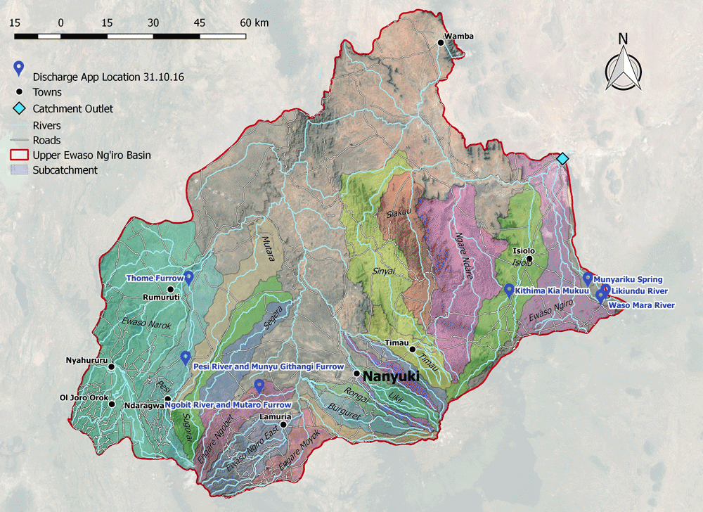
The lack of a proper, dense and functioning monitoring network is critical as the general governmental neglect of the hydrometeorlogical network in Kenya - as elsewhere in Africa - does not allow for proper water resources planning and operational management. The Centre for Training and Integrated Research in ASAL (Arid and semi arid lands) Development (CETRAD), a bilateral institution acting between the Government of Kenya through the Ministry of Water and Irrigation and the Swiss Agency for Development and Cooperation (SDC) through the Centre for Development and Environment of the University of Bern, is partly filling existing institutional and data gaps through their water user associations (WRUA) building activities as well as resource monitoring which they are carrying out for measuring discharge in rivers. CETRAD has requested for the discharge.ch technology be tested at selected sites in the Upper Ewaso Ng'iro Catchment with the plan for later upscaling after the testing phase.

IMPLEMENTATION
...
RESULTS
...